Dinner Key was once an island in the Biscayne Bay, but was connected to the mainland in 1914. With WW1 underway, the need for a continental NAS was rapidly growing. In 1917, the site was chosen for just that job. 1918 brought the commissioning of the station.
 |
| 1917 aerial view of the airfield. Four hangars line the seaplane ramp. From Florida State Archives. |
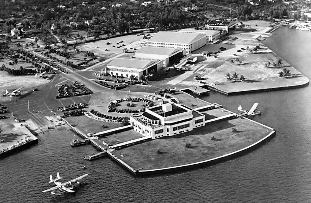
After WW1, the Navy stopped operations at the air station. Instead, the field fell into commercial use. Ten years later, NY, Rio, and Buenos Aires began flights from Dinner Key. In 1930, the airline was merged with Pan Am, which extended service to more locations. The Coast Guard Station Miami was commissioned there in 1932. This was the first "contemporary" aviation unit in the US. The station operated with search and rescue missions, normal patrol, and stopping smugglers. Pan Am built a very Art Deco, Floridian passenger terminal in 1934 (now a satellite Miami City Hall).
 |
| The Pan Am passenger terminal. From David Henderson. |
The 1937 Miami Sectional Chart showed the airfield as two separate facilities. Multiple hangars were demolished and replaced with maintenance hangars or civilian hangars.
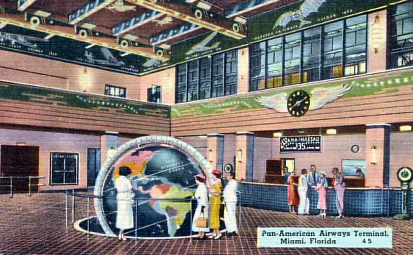 |
A look into the passenger terminal. The globe in the center was a famous landmark in the area. Flights to Havana
and Nassau were $35. From Steve Cruse
|
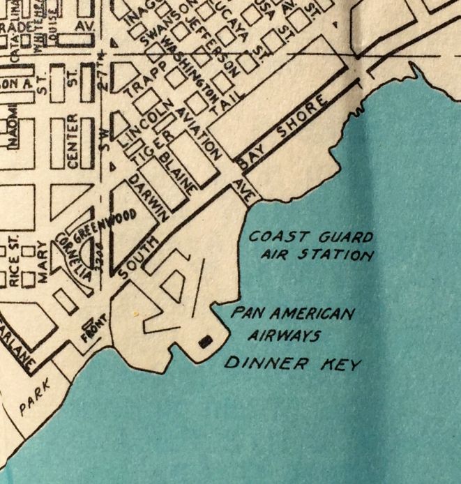 |
| A 1940 map of the area around the airfield from Kevin Walsh. |
With the start of WW2 came more use for the airfield. Support missions and anti-sub crafts were put into use at the field. The Navy resumed use of the field in 1942, conducting winter training there. The entire airfield became a Naval Air Facility in 1943. A new Navy squadron VR-6 was commissioned there in 1943. Equipped with 18 flying boats, the squadron conducted training and transport missions. At the end of WW2, there were four hangars, multiple seaplane ramps, and the passenger terminal.
The NAF was decommissioned in 1945. Pan Am stopped their seaplane operation shortly after the war, moving them to Pan American Field in Miami. This meant that the Coast Guard was the only user of the airfield. The final aeronautical chart with the airfield on it was the Aug. 1954 Miami Sectional Chart. With declining use of CG flying boats, the Coast Guard move all operations to Opa-Locka Exec. Airport in 1965.
All of the structures are still standing and are used for other needs. The terminal is now the satellite city hall location. Two hangars are used for the Grove Key Marina. Another
is a sailing and kayaking center. The globe from the terminal is part of the Miami Museum of Science.

 |
"Hotels-eye" views of the former seaplane structures.
|

 |
| A historical marker giving clues to the former use of the area. |
No comments:
Post a Comment